450 maps for the GO travel magazine
The partnership between Regio and GO began 18 years ago with the publication of the very first issue of the GO travel magazine (now Estonia’s highest-selling travel and hiking periodical) back in 2005. In the intervening years Regio has produced almost 450 maps for the magazine – an average of four or five per issue.
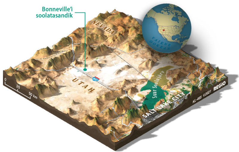
Why half of the Great Salt Lake is red and the other half is blue?
Producing these maps generally requires the cartographer to read through the article in question so that the map matches it as closely as possible. This often means searching online to determine the exact locations of places and sights, which can lead to interesting discoveries. For example, in putting together a map of Utah, the designer wondered why half of the Great Salt Lake appeared to be red and the other half blue. It turns out the lake is divided by a railway line and highway, leaving one half saltier than the other. That makes it attractive to a different species of bacteria – hence the colour difference. Cartographers are curious creatures, and broadening their horizons comes naturally to them. It’s often assumed that geography classes at university fill their heads with nothing but place names and names of natural features, but that’s not the case at all.
The maps in the magazine cover a wide range of geographical areas and are produced to different scales. This creates plenty of scope for visual experimentation. Efforts were made in the past to standardise the maps in the magazine, but this proved boring for the cartographers and the readers alike. The ‘classic’ is an overview map of a country, but much more detailed representations of small areas and route maps covering whole pages also need to be made.
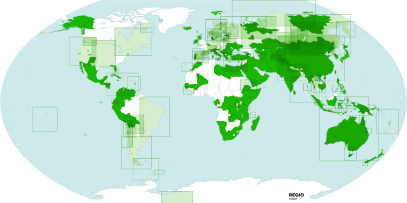
Below you can see how many countries and regions we’ve mapped for GO magazine. Those in dark green are the aforementioned overview maps we’ve produced for a specific country or administrative district. The areas marked in white don’t necessarily mean the magazine has never published a story about them, but simply that they’re still awaiting discovery by our cartographers.
Enjoy our maps and your travels through the pages of GO magazine!