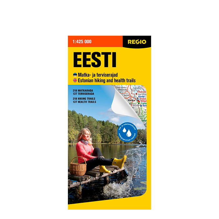
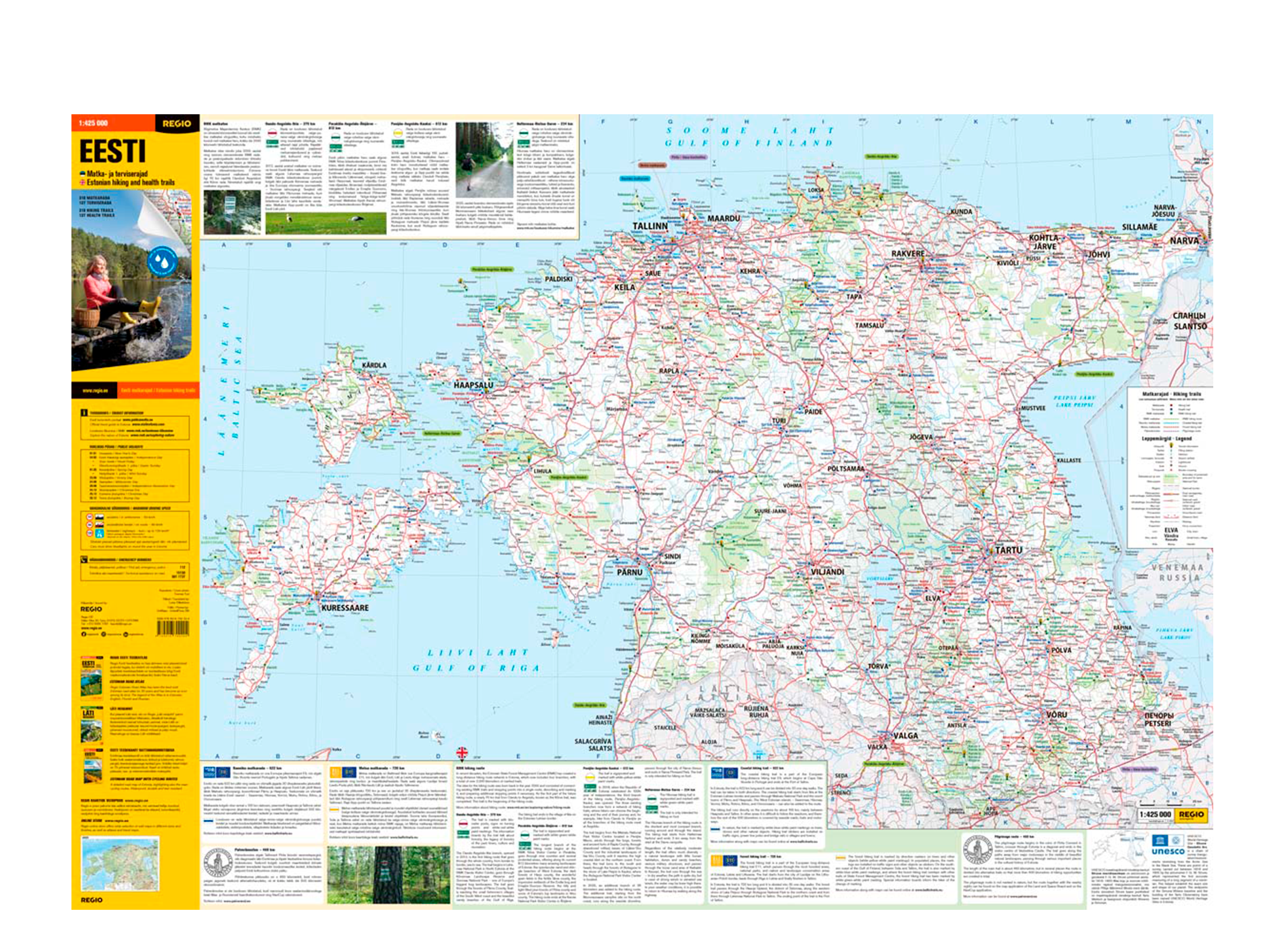
Description
- The easy-to-fold map is waterproof.
- Fits easily into a car glove compartment, bag, or pocket.
- One side features a road map of Estonia with information about hiking trails. The map also shows churches, lighthouses, national parks, fuel stations with service facilities, and major ports.
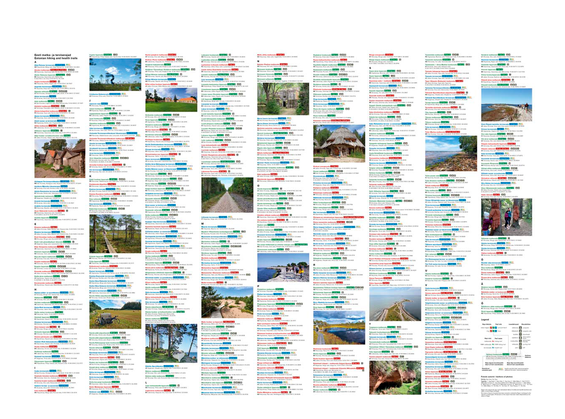
- On the reverse side, the map provides brief descriptions of the hiking trails shown on the map, including the starting point address, coordinates, trail length and type, and whether the trail includes a camping area, observation tower or other amenities.
- The map legend and hiking trail descriptions are in Estonian and English.
Features:
- 318 hiking trails
- 137 health trails
- State Forest Management Centre (RMK) Hiking Route. Over the past decades, RMK has developed a nationwide network of hiking routes, now consisting of four branches and totaling over 2,000 kilometers of marked trails.
- The Coastal Hiking Route, which is part of the European long-distance trail E9, beginning in Portugal and ending at the Port of Tallinn. In Estonia, the route is 622 km long and can be divided into 30 one-day hikes.
- The Pilgrimage Route, which starts in Tallinn at the ruins of the Bridgettine Convent in Pirita, runs diagonally across Estonia and ends at the Vastseliina Episcopal Castle Visitor Centre.
- The Forest Hiking Trail, which is a part of the Baltic section of the European long-distance trail E11. This trail passes through the most forested areas, national parks, and nature and landscape conservation areas of Estonia, Latvia, and Lithuania. In Estonia, the trail is 720 km long.
- The Struve Geodetic Arc, which is listed as a UNESCO World Heritage site — a triangulation chain established between 1816 and 1855 under the direction of astronomer and geodesist F. G. W. Struve for measuring the shape and size of the Earth.
ISBN 9789916700204